
VGP - Let's contemplate the beauty of the Dak Nong Geopark which has been recognized by the UNESCO as a Global Geopark.
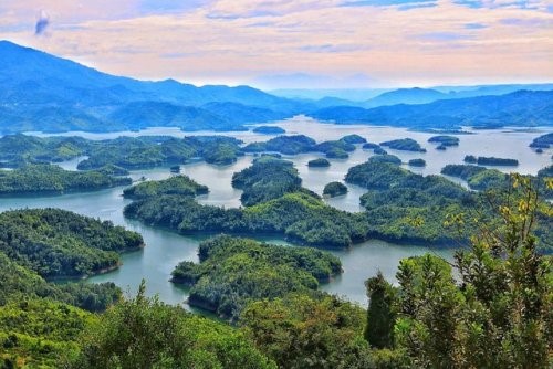
Located on the M'Nong plateau at average elevation of 600-700m asl, with the highest point being Ta Dung at 1,982m asl, Dak Nong Geopark - the Land of Sounds - (coordinates N12o17'48"; E107o46'58") covers an area of c.4,760km2 of the northern districts of Dak Nong Province in Viet Nam's Central Highlands
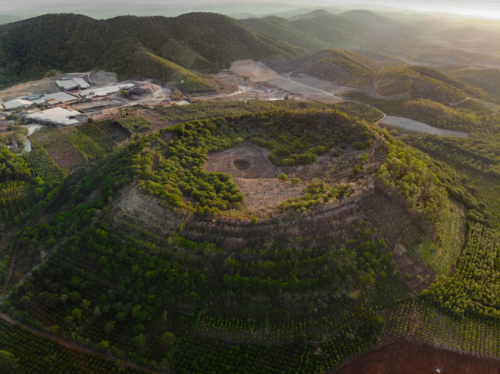
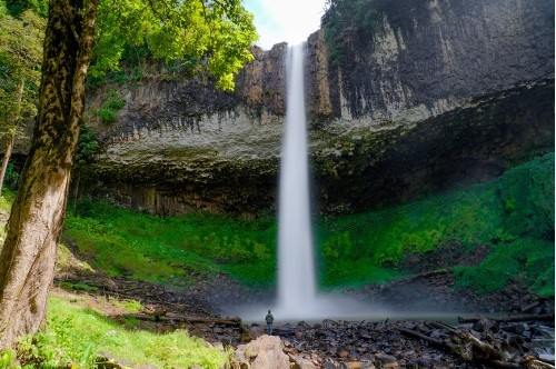
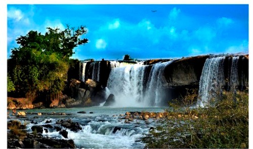
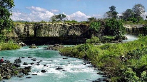
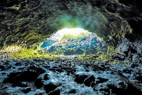
In particular, young volcanic activities about tens of thousands of years ago (Late Pleistocene-Holocene) have resulted in spectacular craters, majestic waterfalls and Southeast Asia's most extensive system of hundreds of magnificent volcanic caves, many of which have been used by prehistoric people as shelter since at least 6,000-10,000 years ago.
Characterized by sub-equatorial tropical monsoon and plateau climate, the area features an evenly distributed network of rivers, streams, lakes and reservoirs.
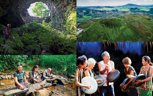
A population of c.416,000 people of 40 ethnic groups, including 3 autochthonous, live in the area, occupied mostly in agro-forestry, trade and services, and small industries. Many archaeological, historical and cultural relics as well as scenic spots are recognized and conserved. Many festivals and traditions celebrated by ethnic cultures, in particular the UNESCO "Gong Culture Space" intangible heritage (including the man's oldest lithophone) also contribute to the values of the Geopark.
Being a piece of the Gondwana ancient supercontinent, from about 200-165 Ma ago it was deeply submerged into a passive continent marginal sea, very rich in ammonite and bivalve fossils. This continental margin later, during 145-66 Ma ago became active due to plate collision, with red-bed sediments, eruptive and esite-dacite-rhyolite and intrusive gabbro-diorite-granodiorite-granite rocks.
During the last 16.5 Ma, the territory became active again with wide-spread, multi-phase volcanic activities, forming a basalt cover over more than 50% of the Geopark area.
These have been the source of some of the world's largest and top quality bauxite deposits and a number of other minerals (sapphire, semi-precious stones etc.), and especially the fertile soils that have fed generations of local people with many industrial and fruit tree crops.
Source: Chinhphu.vn
Weather
| Đắk Nông | |
| Pleiku | |
| TP Hồ Chí Minh | |